Posts

Showing posts with the label GIS 4035 - Photo Int

Module 5: Unsupervised & Supervised Classification

Module 5: Unsupervised & Supervised Classification

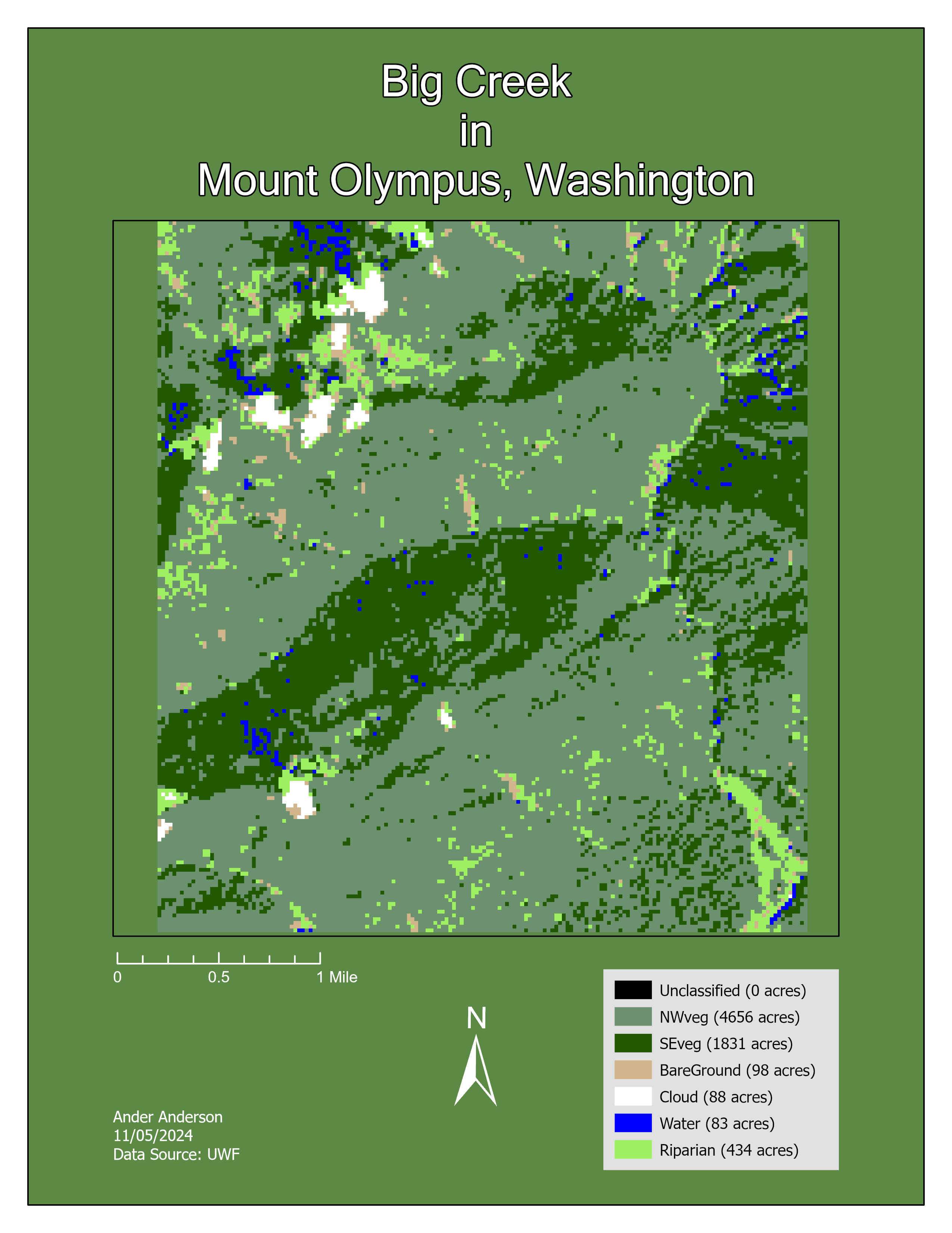
Module 5 covered Classification of Images in ERDAS, Collecting, Evaluating Spectral Signatures, and Unsupervised and Supervised Classification of Images 

For Exercise 1 I tried several times and different ways to recode to get rid of the unclassified and could not in ERDAS. 

In Exercise 2 I also could not get Unclassified to recode in ERDAS but was able to reclassify it out in ArcPro. 

I spent an embarrassing amount of time trying to figure out why my color boxes disappeared from my attribute table, which turned out to be a problem with the CITRIX view. Once I unmaximized the window, I could suddenly see the whole box. Since this has been an issue before, it should have occurred to me sooner. 
I also did not notice the very large and probably incorrect acreage on the Roads until it was a bit too late to turn back. 


Module 4: Spatial Enhancement, Multispectral Data, and Band Indices

Module 4: Spatial Enhancement, Multispectral Data, and Band Indices


Module 4 we learned how to download and import satellite imagery, explore and interpret histogram data, identify features using that data, and create spectral band indices. 

I used the grayscale layers to find the first two features by using the histogram in the metadata and inquire on the maps. I then used the band combinations from the Lab Exercises. 

The first feature in Layer 4 was Puget Sound. From the spike I knew it was a dark color and inquired all the relevant areas on the map till I found the one that matched. 


The second feature the represents both small and large spikes is Mount Olympus, after looking at the histograms I knew that the area would be dark and bright so I inquired the Mountain area first and it matched.


The third feature I opened in True color since I knew I would be looking for variations in water and found those variations in the North Bay area.


Module 3: Intro to ERDAS Imagine and Digital Data

Module 3: Intro to ERDAS Imagine and Digital Data


Module 3 was in two parts. First part had us calculating wavelength, frequency, and energy of EMR, and the basics of ERDAS Imagine. 

Second part had us delve more into ERDAS Imagine.

Overall I only really struggled with the various calculations but math has never been my strongest subject. 


Map is a subsection of Mount Olympus around the Big Bend Area taken from ERDAS Imagine using the Inquire Box.


Module 2: LULC Classification and Ground Truthing

 Module 2: LULC Classification and Ground Truthing


Module 2 had us learning about Land Use and Land Cover Classification and Ground Truthing. 

We created a land use/land cover map of a section of Pascagoula Mississippi and measured our accuracy using Google Street View. 

I really had to keep in mind to not to get lost in time with the details and forced myself to be create broader polygons. 

I made my classifications off of the ones provided in the lab. 

Land Use and Land Cover in Pascagoula, Mississippi


Module 1 Lab: Visual Interpretation

Module 1 Lab: Visual Interpretation


First week of Photo Interpretation and Remote Sensing had us developing skills in identifying and classifying the tone and texture in aerial photographs, identifying features in an aerial photograph based on shape and size, shadow, pattern, and association, and interpreting features in true color and false color in infrared images. 

I did not struggle with any of the tools used in the lab.

Aerial Photograph labeled with Tone and Texture


I believe that I understood the material to appropriately label the required items. 

Aerial Photograph labeled with Identifying Features